Walk the Streets the Brotherhood characters walked!
Updated 2020
The amazing librarians at Carver Middle School in Chester, VA, helped me design this walking tour of Shockoe Bottom and Church Hill, and the equally amazing librarians at Liberty Middle School in Ashland, VA, helped me refine it! Stroll these Richmond, VA, streets and listen to audio recordings of me reading short passages from Brotherhood. Scan each QR Code to listen.
Note that Richmond’s ever-changing construction might throw a roadblock in your path (pun intended), so give yourself time to park and walk, as conditions may change. Here’s a printable version (PDF) of the walking tour.
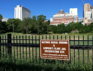
Start at the Lumpkin’s Jail historical markers. Below is a map of the area with a red X at the location of the markers.
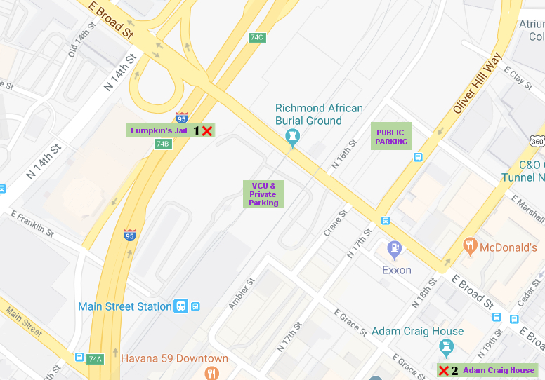
This site is part of the African American Burial Grounds, a large grassy area east of I-95 and north of Broad Street, which continues under the road (via a pedestrian underpass) to the VCU parking area behind Main Street Station (Amtrak).
 You can access the burial grounds from the parking lot at E. Marshall and Broad Streets (go to the end of E. Marshall Street), or from the VCU lot, or from the lot behind Amtrak (but sometimes those two are under construction). Note that Google’s map shows 16th Street, but you won’t see a street sign for it. 16th St. is just an entrance to the parking lot. There’s another public lot at 15th and E. Main Street, across from Main Street Station’s front entrance (not shown on the map above; if my map were slightly larger, you’d find that parking lot at the bottom left corner, underneath I-95).

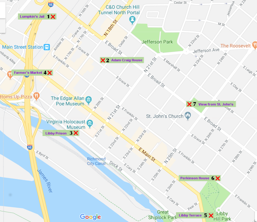
2. With the Lumpkin’s Jail historical markers behind you, walk through the VCU parking lot to Grace Street. Between 18th and 19th Streets, the Adam Craig House will be on your left (1812 E. Grace St.). This is the house where I imagined the character, Maggie, to have lived.

3. Continue east on Grace Street to 20th Street and turn right. Walk until 20th Street ends at the flood wall on Cary Street, and you’ll see the Libby Prison historical marker. The prison used to stretch a full block east from the corner of S. 20th Street and E. Cary Street.

4. With your back to the flood wall, turn left and walk west on Cary Street. Go to 17th Street and turn right. Go one block to 17th and Main Streets, where you’ll see the Farmer’s Market on the north side of Main. On your right corner will be the brick building where I imagined Granddaddy had lived and kept his shop, Weaver’s Fine Tailoring. Painted on the side of the building are the words, “TEAS, COFFEES and SUGARS are the best.”

The Farmer’s Market
5. Libby Hill. Return to your vehicle and drive east on Broad Street, up the hill to 29th Street (you’ll go past St. John’s Church), and turn right. 29th Street will end at Libby Hill Terrace. This is the overlook with a gorgeous view of the James River.

6. Walk to the corner of 28th Street and E. Franklin Street. This is the location where I imagined Rachel and the Perkinsons to have lived. An engineer’s map of Richmond in 1865 indicates that there was an alley behind the house on this corner; the view from the front is of Libby Hill Park.

7. To walk to St. John’s Church, take 28th Street for 2 blocks to E. Broad Street. Turn left, walk 3 blocks, and you’ll find the church stretching the entire block between 24th and 25th Streets. For a tour of the grounds, please go to www.HistoricStJohnsChurch.org and schedule your visit in advance.

That’s it for the walking tour! I hope that this tour helps you picture Shad and Rachel and all of the characters depicted in Brotherhood.
If you have time to stay longer in Richmond, you might want to visit the American Civil War Museum at Historic Tredegar. Below is an audio clip of me reading a bit about Tredegar. To get there from Church Hill, drive back down Broad Street to 5th Street, turn left, and stay on 5th until it ends at Tredegar Street. You’ll see the canal in front of you. Turn right and you’ll soon come to Tredegar on your right (the parking lot has plenty of room for buses). Visit www.ACWM.org for information about tours and rates.

I’d also recommend the Virginia Museum of History and Culture at 428 N. Arthur Ashe Boulevard, Richmond. You’ll find plenty of parking behind the building, and information about their tours at www.virginiahistory.org.